
Troughton
The Troughton Island airstrip
North Kimberley Airport operates Troughton Island airstrip as an alternate to North Kimerley Airport. It has a 980m x 30m unsealed runway.
(See the airstrip on Google Maps)
Troughton Island sits 6 metres above sea level on a natural reef. Troughton is managed by two people who spend one month at a time on the island. During that time they are almost completely isolated from the outside world. Although they are isolated they are not alone; previous occupants of the island brought in quails and children's pythons that were once pets that escaped their cages during a cyclone.
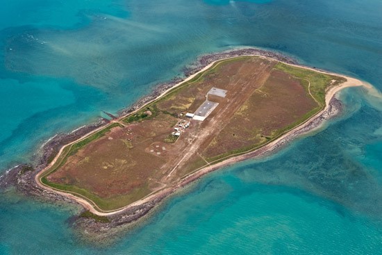
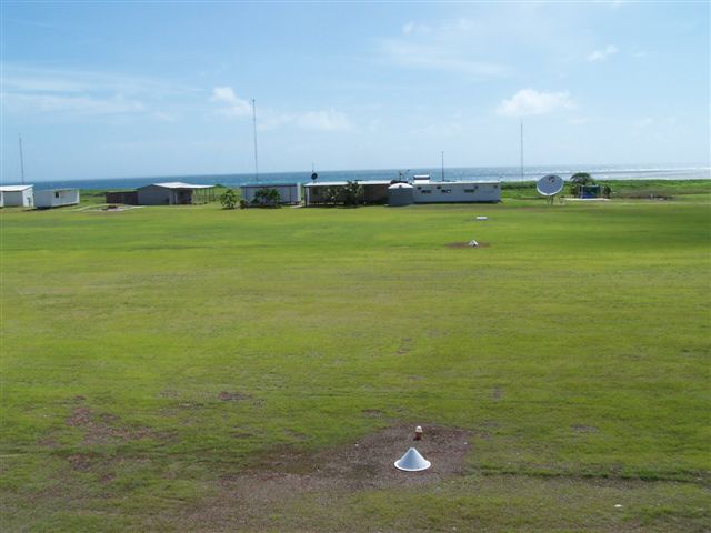
Today Troughton Island is maintained as an emergency landing area for aircraft that are unable to reach North Kimberley Airport. It also serves as a landing area if North Kimberley Airport is inaccessible due to weather conditions. The Burea of Meteorology has a weather station on Troughton island.
North Kimberley Airport aerodrome supports all the FPSO (floating production storage and offloading facility) operations in the WA and NT waters of the Timor Sea, while our alternate aerodrome at Troughton Island is 20 nautical miles north of the main air route to Timor Sea facilities.
Troughton Specifications:
Troughton Island airstrip details
| Download ERSA PDF | Download Runway Distance Suppliment PDF |