
North Kimberley Airport
The North Kimberley Airport
North Kimberley Airport occupies 46 km2 of native title land, its use is governed by a long-term lease agreement between North Kimberley Airport and the Wunambal Gaambera Aboriginal Corporation (“WGAC”). North Kimberley Airport was given CASA registration R093 in April 2005.
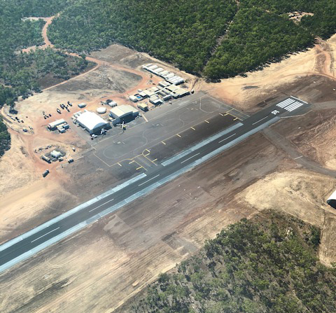
The 1800m x 30m sealed runway provides significant efficiencies for aviation operations in the Kimberley and Timor Sea areas of northern Australia. The airport can support narrow-body airline and charter traffic, making direct flights to and from state capitals a feasible option for oil and gas and other offshore operators, as well as enabling emergency support services to be provided to offshore operations and the ability to facilitate convenient visits by company executives to offshore facilities. It has all the equipment and facilities necessary to provide aviation logistic support to operations including coastal surveillance services, the oil and gas industry, pearling, aquaculture, fisheries, minerals exploration and mining, aerial surveys, defence, tourism and other operations requiring a support base in the Kimberley.
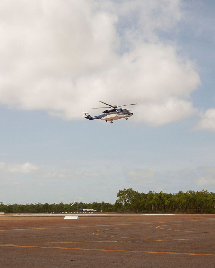
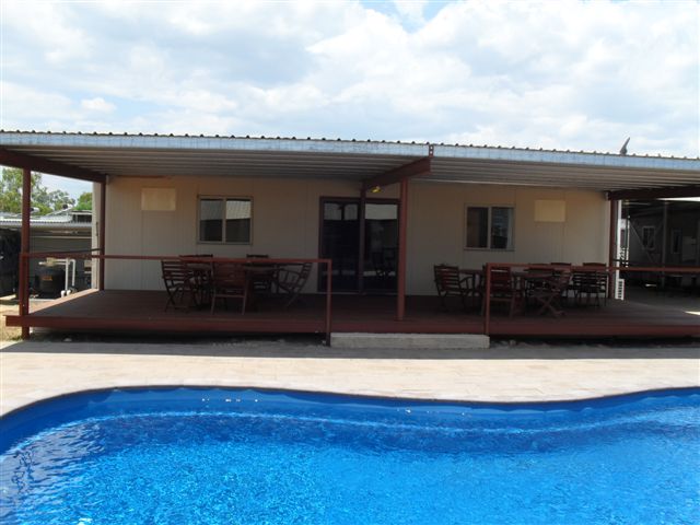
All buildings are cyclone-rated and termite-treated, with 80 en-suite single accommodation rooms. Hangar One, measuring 529m², can accommodate one S92 helicopters, while Hangar Two, measuring 774m², can accommodate three S92 helicopters.
(see the base on Google Maps)
Voice and data communications are provided through Telstra's high capacity radio concentrator (HCRC) system, in conjunction with internet access through a broadband two-way satellite system. Equipment also includes HF radio back-up through VJY and fixed and mobile aviation VHF transmission.
Regional operators Airnorth, Paspaley Aviation, Hardy Aviation, National Jet Express, Nexus Aviation and Alliance Airlines use North Kimberley Airport, with a variety of aircraft including Fokker 70, Embraer 170, Metro 23, Embraer 120, Dash 8 types and Beechcraft 1900. Offshore Services Australasia and CHC Helicopters currently maintain and operate S92 helicopters from the airport.
All stores, office and workshops are dust-proofed and air-conditioned. En-suite accommodation is provided for up to 80 personnel. Communal facilities comprise an air-conditioned lounge with Foxtel, swimming pool, dining room, kitchen, gymnasium/poolroom, transit lounge and outdoor recreational facilities.
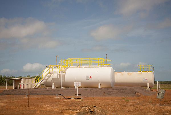
Jet A1 aviation fuel is dispensed airside through aircraft refuelling trucks with a maximum holding of 180,000 litres; for under wing or pressure refuelling. Avgas is supplied on an as required basis. Dedicated barge services delivers fuel by sea to the landing area at West Bay, 10km east of the camp. Single barge capacity is 130 tonnes with approximately 60 kilolitres regularly taken up with fuel. Delivery frequency is matched to fuel requirements.
North Kimberley Airport Specifications:
North Kimberley Airport Aerodrome details
| Download ERSA PDF | Download Runway Distance Suppliment PDF |
Communications
Six x Telstra lines via Telstra’s DRCS system (Telstra Upgrades -This system is currently being replaced by a new High Capacity Radio Concentrator (HCRC) system, in conjunction with the Big Pond Broadband two-way satellite system which has been installed.)
- Three lines dedicated to voice
- One line dedicated to computer modem
- Two lines dedicated to Canon 450 facsimile machines
- DRCS (HCRC) system coupled to emergency landline phones
- 3 x cordless wifi phones, 3 x desk phones powered via VoIP hosted phone system
- 2 x internet satellite data connections
Emergency Backup
- 2 x satellite telephones (one hand-held and one base-supported)
Radio
- Two x radio – VHF, ground to air communication, ops and camp office
- 1 x radio – HF with links via VJY to the Telstra network
- One x PA system
Navigational Aids
- 1 x set PAPI (precision approach pathway indicator) runway lighting
- 1 x set PAL (pilot-activated lighting) solar/battery-powered runway lights
- 1 x runway lights for emergency operation
- 1 x floodlit windsock with signal circle
- 1 x AFRU (aviation frequency response unit)
Meteorological
Data is gathered by a remote automatic weather station provided by the Australian Bureau of Meteorology, which feeds into the national forecasting data base.
The Automatic Weather Station at North Kimberley Airport is Almos based, as found at all BOM sites around Australia. Installed sensors are:
- 10m anemometer for wind speed and direction at 10m,
- Barometer for station level pressure, QFF and QNH,
- Stevenson screen with RTD temperature sensor and humidity probe,
- Rain gauge for rainfall and independent internal rain intensity logger,
- Cloud height and horizontal visibility metering equipment.
Additional Documents
I you wish to obtain a copy of an additional documents, plans & drawings of the North Kimberley Airport, please contact us through the contact page. alternatively click the below button to jump to the contact page.
Flying Distances Chart
Distances between operational centres.
Notes: Dampier (Karratha aerodrome), Distances are calculated as great circles to the nearest nautical mile.
Conversion: 1 nautical mile = 1.85319km, 1 nautical mile = 1.141414 statue miles, 1 statue mile = 1.609342km.